Ku-ring-gai Draft Green Grid Strategy

What's happening

CONSULTATION NOW CLOSED

Ku-ring-gai Council has developed a draft Green Grid Strategy as part of the Sydney Green Grid initiative and is seeking community feedback.

The Green Grid aims to connect key areas throughout the region, including public and private open spaces, national parks, bushland, suburbs, local centres and neighbouring local government areas (LGAs).

About the strategy

The draft Ku-ring-gai Green Grid Strategy outlines the strategic context and vision and objectives for a Green Grid across the council area.

In simple terms, the Green Grid can be described as “a network of corridors to connect green spaces and centres”. These corridors are made up of paths, bike lanes, trails, and vegetation. This means they serve the dual purpose of allowing people to walk or use active transport to get between open spaces and centres and serve as ecological corridors to promote biodiversity.

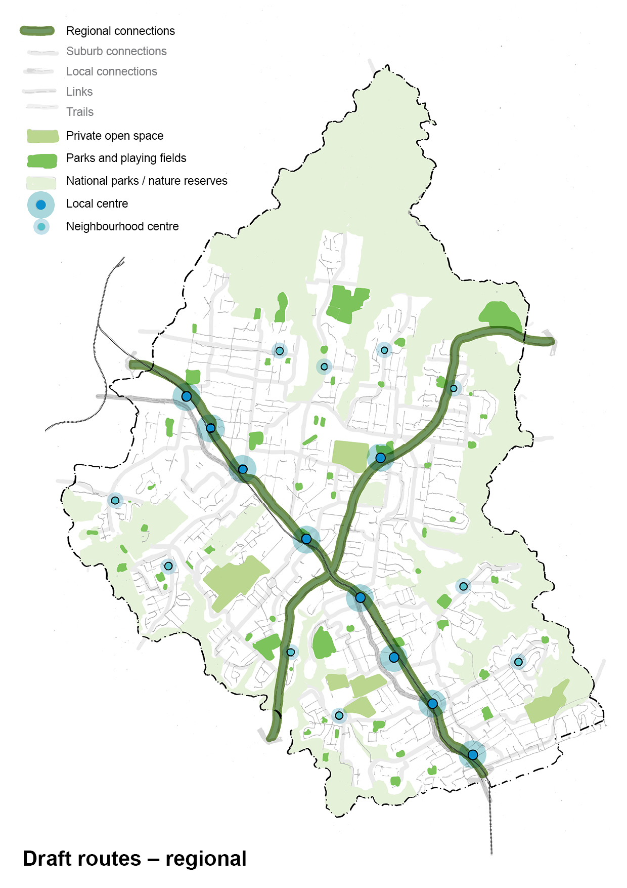
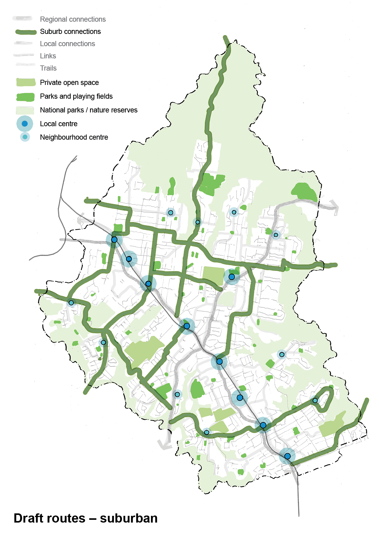
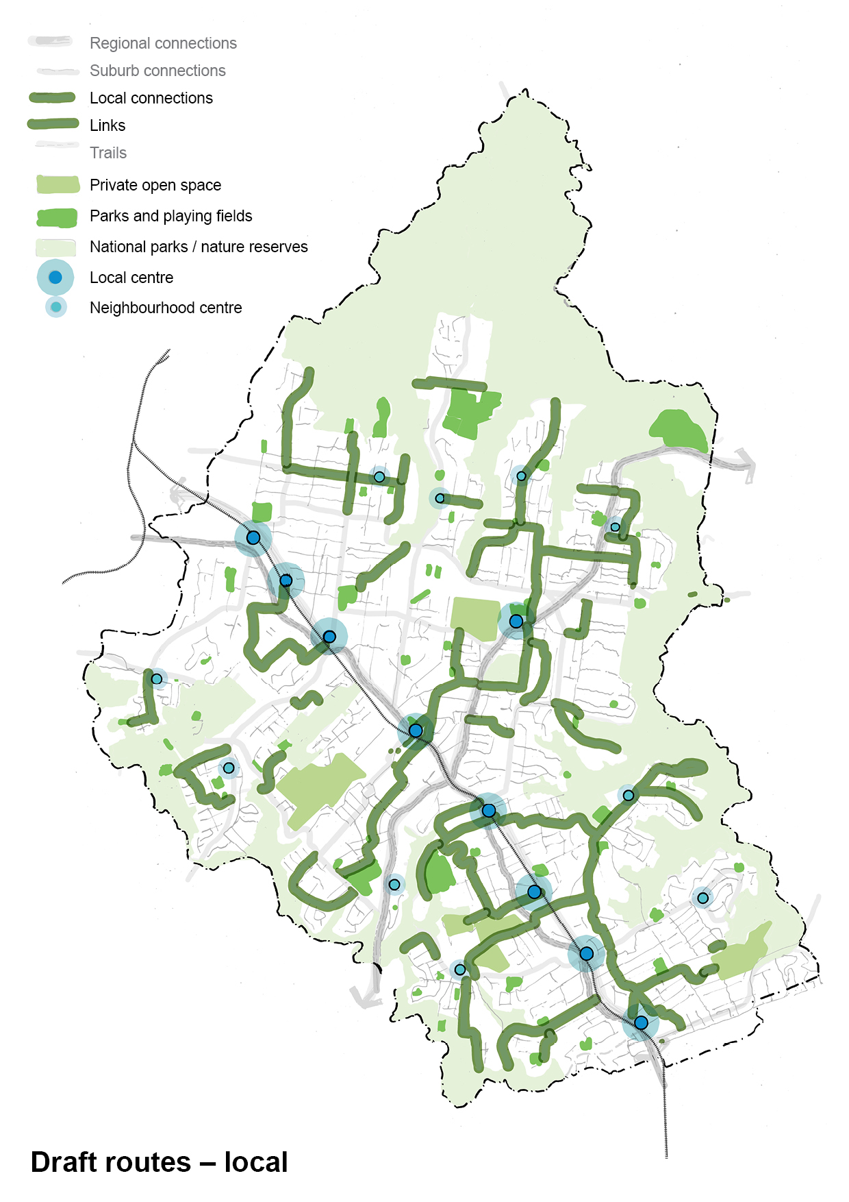
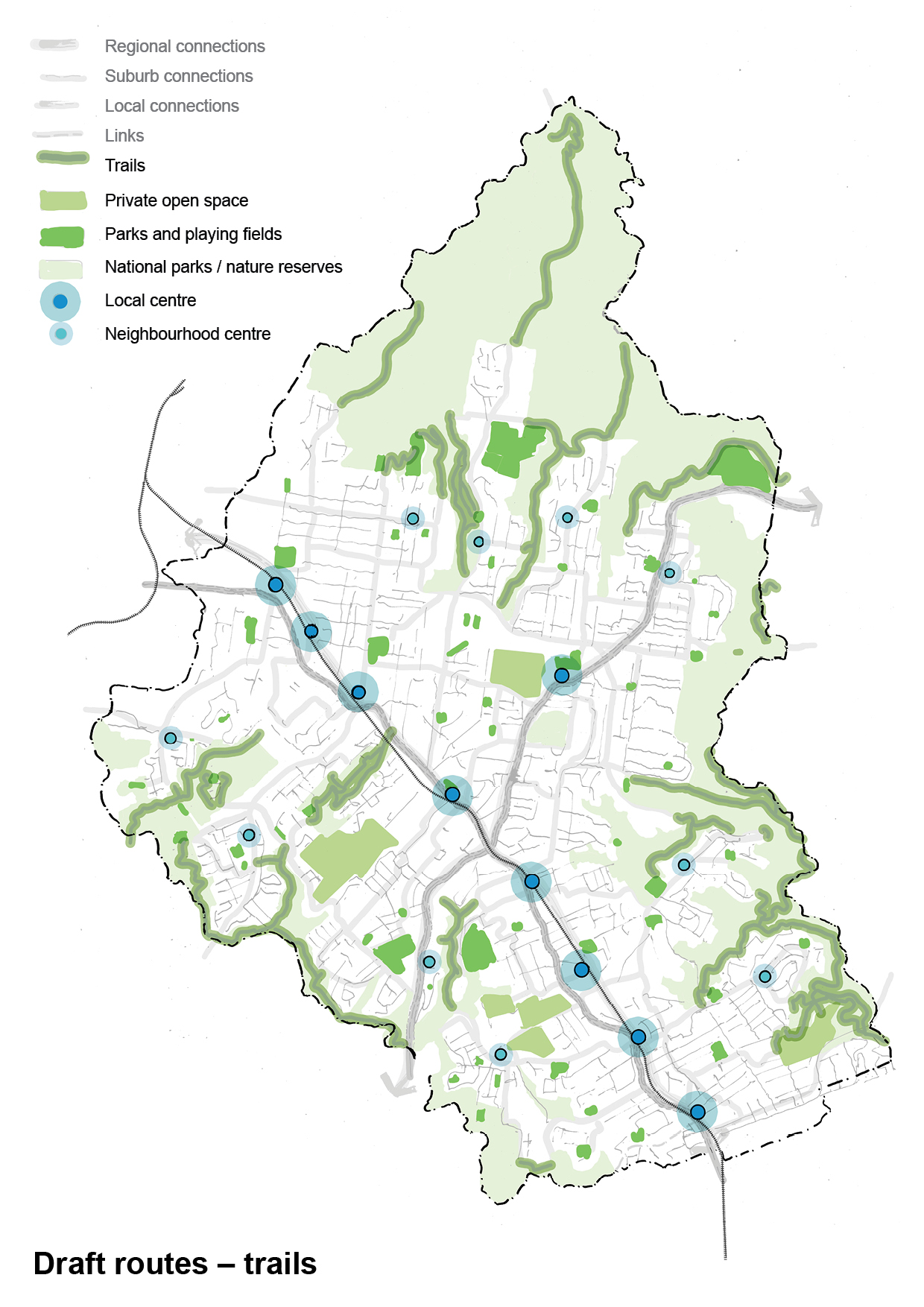
The draft Strategy also shows a series of proposed of Regional, and Suburban routes, and Local and Trail Links, along with the evidence base to support these proposed links.

Objectives of the Green Grid in Ku-ring-gai

1) Increased canopy cover across the LGA

Ku-ring-gai benefits from a well-established and extensive urban tree canopy. Pressures from development, climate change and risk mitigation all impact on how this can thrive and expand. Clear targets for the delivery of an improved urban forest canopy are essential for ensuring the longevity and success of our urban forest. Green Grid projects are fundamental to achieving this.

2) A consolidated active transport network providing comfortable walking and cycling routes

Active transport is critical in sustainable progress towards meeting climate change mitigation targets. Council is pursuing opportunities to develop the best possible links that provide the infrastructure to support both walking and cycling transport options. Integral to the comfort of these routes is shade and an aesthetically pleasing environment, which co-ordinated street tree planting as part of the Green Grid can deliver.

3) Walkable connections between points of interest in the LGA

Local Centres, historic sites, parks and recreation facilities all provide points of interest within the LGA which residents want to access. The Ku-ring-gai Green Grid will endeavour to make walking the preferred way to get to, from and between these points by improving green infrastructure interventions along these routes, ensuring they are shaded, pleasant and accessible.

4) Enhanced biodiversity and riparian corridors

Fundamental to the Green Grid is the enhancement and protection of our existing natural systems. These need to be supported and expanded wherever possible. The balance needs to be struck between creating new connections to re-link patches of bushland and allowing the appropriate level of access to sensitive areas.

Routes hierarchy

Grid components

Transforming these routes into green corridors will include the following key components

Street trees

Street trees

Street tree planting - new trees will be planted on streets where there are opportunities, focussing on those areas with low canopy cover.

Footpaths and bike lanes

Footpaths and bike lanes

Whilst the aim is to work with routes that already have existing infrastructure, where new footpaths, shared paths or bike lanes need to be built this will be co-ordinated with street tree and under planting, passive irrigation, traffic calming,...

Verge gardens

Verge gardens

Verge and median planting - wherever possible, layered, biodiverse native planting will be incorporated

Cable bundling

Cable bundling

Aerial cable bundling or undergrounding of power - where undergrounding of power is cost-prohibitive, aerial cable bundling will be incorporated to provide increased opportunity for canopy trees.

Rain gardens

Rain gardens

Water sensitive urban design treatments - rain gardens to capture and filter stormwater run-off, passive irrigation such as breaks in kerbs, and swales.

Signage

Signage

Interpretive signage - signs along routes that highlight culturally significant information around first nations history wand native fauna and flora

Read the Draft Green Grid Strategy

Consultation closed on 12 March. We are now analysing the results.

Next steps

Community input is vital to our Green Grid Strategy. Feedback from this public exhibition be used for finalise the draft for adopting by Council.

After adopting this draft, we'll conduct ward-by-ward consultations to refine proposed routes, including onsite meetings in local parks to understand how residents move through their neighbourhoods and where access improvements are needed.

The action plan will prioritise routes that deliver multiple benefits - from ecological to cultural - with implementation details developed collaboratively with the community. The final plan will specify route locations, required infrastructure, delivery timeframes, funding sources and responsible teams.